


Complying with the order of the Jammu Kashmir administration, the officials have prepared a list of the patches of state land in the Kulgam district of south Kashmir.
The Kashmiriyat has learned that a total of 9597 patches of land registered under various Khasra numbers have been listed under various state land categories of the state land in the south Kashmir region out of which 5295 patches of land have been “encroached” upon while 4284 patches of land are vacant.
ALSO READ: 1,65,000 Kanal of land marked as ‘state land’ by officials in Srinagar, details here:
1392 patches of land out of those listed as “Encroached” are being used for agricultural purposes, as per the documents.
The documents reveal that a total of 93,063 Kanal (11632.8738 acres) of land have been mentioned as state land under the categories Gair Mumkin, Bajar e Kadeem, and Labroo among several others.
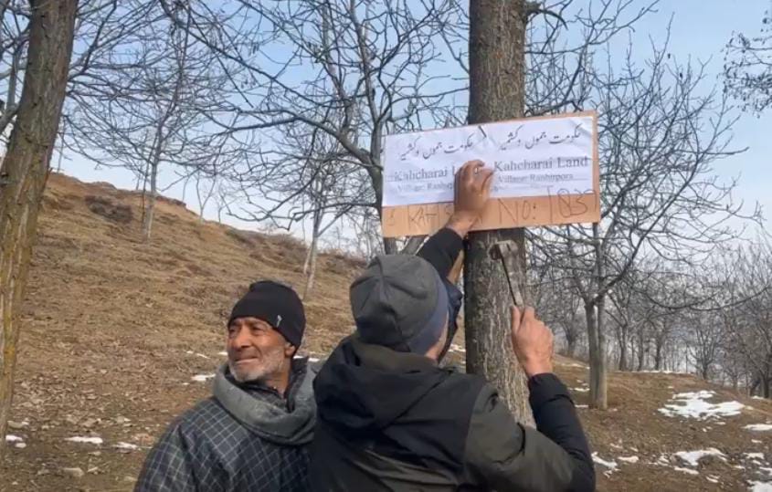
ALSO READ: Officials mark over 75,000 Kanal of land ‘state land’ in Shopian district, details here:
A Revenue official, who wished to remain anonymous told The Kashmiriyat that they have been asked to ensure a hundred percent removal of encroachment on state land, Ghas Charai and Roshni Land. “There are likely to be extensions against the timeline fixed as of now (January 31),” he said, adding, the lists have been prepared as per the 2001 revenue census. “There have been many more encroachments after 2001,” he told.
LG Manoj Sinha has said that common masses and poor people wouldn’t be touched during the ongoing drive launched by his administration to retrieve state land from encroachers. “Common man and poor people wouldn’t be touched by the administration. The government is concerned to safeguard the interests of poor people,” he said.
Meanwhile in Kupwara district of north Kashmir, officials said, at least 4021 kanal of “state land” was retrieved.
ALSO READ: State land ‘retrieval’ drives intensified across Kashmir: Here is the area wise list of state land in Anantnag
As per the reports of Tehsildar Drugmulla, 301 kanals of kahcharai land have been retrieved in Drugmulla tehsil of Kupwara district which include 276 kanals single patch of land and 25 kanals which was used as commercial purposes.
Likewise, as per Tehsildar Kupwara, 280 kanals of land have been retrieved during the drive till date in Kupwara tehsil which include 205 kanal kahcharai Land and 75 kanal state land.
In the list prepared by officials in Kulgam, The Kashmiriyat learned that over 15, 067 Kanal (1883.374803 acre) of land have been marked as state land in the Devsar tehsil of the south Kashmir district.
The area wise breakdown shows, Churath has 263 K 19 M of state land, as per the officials, Chowgam 347 K 10 M, Pratabpora 322 K 8 M, Khargund 163 K 8 M, Gundipora 229 K 15 M, Kanchloo 151 K 2 M, Akhal 2550 K 16 M, Dargund 2146 K 4 M, Brenal Lamar 1055 K 19, Yarhal Babapora 315 Kanal 10 M, Bonigam 83 K 4 M, Balhama 17 K 3, Neva 33 K 8 M, Kelam 677 K 2 M, Kadoora 45 K 9 M, Khagund 33 K 16 M, Hablishi 242 K 8 M, Nalipora 10 K 13 M, Dantri 8 K 1 M, Hanjipora 122 K 15 M, Akhran 371 K 8 M, Nowgam Devsar 18 K 3 M, Manigam 381 K 17 M, Palpora 264 K 1 M, Nowpora 844 K 8 M, Bona Devsar 387 Kanal 01 Marla, Barigam 21 K 13 M, Cheyan 106 K 12 M, Qasba e Devsar 406 K 7 M, Agaroo 10 K 4 M, Zeypora 8 K 4 M, GT Pora 2631 K 3 M, Sopat Tengpora 253 K 12 M, Adigam 55 K 13 M, Banghall 4 K 4 M, Mondhal 181 K 17 M, Chandian Pajan 165 K 13 M.
Pehloo Tehsil in Kulgam has 9309 kanal (1163.625 acre) of land falling under various categories of state land, as per the document.
Pehloo 650 K 15, Shaho Shichan 52 K, Ashtal 1931 K 12 M, Gudar 640 K 10 M, Banimulla 125 K 13 M, Chambgund 1570 K 13 M, Pranhal 110 K 13 M, Malwan 434 K 16 M, Khaloora 698 K 3 M, Lankar Pombay 67 K 4 M, Chanderji 16 K 14 M, Mangalpora 83 K 10 M, Batpora Vailoo 3 K 10 M, Zangalora 891 K 8 M, Chitripora 270 K 6 M, Gasiraina 501 K 8 M, Aari Gatnoo 1268 K 8 M.
As per the document, Quimoh tehsil of Kulgam district has 5920 Kanal (739.9999 acre) marked as state land. The area wise breakdown is as follows:
Tuli Nowpora 141 K 9 M, Matalhama 358 K 1 M, Mah 1683 K 15 M, Khrewan 911 K 8 M, Bhan 15 K 8 M, Quimoh 720 K 11 M, Redwani 502 K 5 M, Rampora 35 K M, Hawoora 90 K 17 M, Wanpora 272 K 8 M, Batpora Anantnag 26 K 13 M, Bat Tachloo 116 K 10 M, Uudipora 5 K 10 M, Kalipora 23 K 2 M, Bogund 87 K 13 M , Danew 11 K 6 M, Wazirpora 9 M, Makandpora 18 K 16 M, Khudwani 564 K 4 M, Mughal Bagh 18 K 14 M, Bagh Wanpoh 107 K 15 M, Khrewan Lassipora 218 K 12 M.
The documents available with The Kashmiriyat shows that Damhal Hanjipora has over 32, 122 Kanal (4015.249581 acre) of land falling under various categories of state land. The land is being used for purposes varying from farming to commercial and residential purposes among others.
Chimmer 3047 K 7 M, Kutmarg 931 K 12 M, Gulzarabad 1273 K 2 M, Badijihalan 696 K 13 M, Nagnad 429 K 7 M, Ahmedabad 1038 K 9 M, Kounsarbal 325 K 10 M, Qasba e Khul 1296 K 1 M, Ringat 22 K 1 M, Lyserpora 49 K 16 M, Regipora 47 K 11 M, Durhama 1 K 16 M, Awel 574 K 13 M, HM Guri 458 K 15 M, CS Rather 44 K 19 M, Waripora 29 K 4 m, DH Pora 1855 K 19 M, Machigam Jagir 40 K, Bathipora 592 K 4 M, Sonamula 7 K 3 M, Kokerhama 66 K 3 M, Hariwath 31 K 1 M, Ladgoo Ramhama 1038 K 7 M, Atoo 2488 K 14 M, DK Marg 3989 K 8 M, Ladawpora 33 K 4 M, Nagam 1376 K 17 M, Boh 1494 K 17 M, Gandwini 43 K 14 M, Yaroo 839 K 19 M, Nehama 1149 K 6 M, Lakdipora 42 K 3 M, Kamoshigam Khalisa 6 K 11 M, Samnoo 59 K 12 M, Lysoo 861 K 17 M, Asnoor 830 K 02 M, Koriel 83 K 5 M, Mirwani 890 K 8 M, Raiwatan 17 K 3 M, KB Pora Khalisa 1627 K 13 M, KB Pora Jagir 87 K 7 M, Manzgam 637 K, Nandimarg 495 K 4 M, Gojjpera/ Danipora 11 K 8 M, Yarikhah 946 K 6 M, Yarikhah 232 K.
Area wise breakdown of Frisal with over 1300 Kanal (162.5 acres) marked as “state land” are as follows:
Frisal 99 K 5 M, Budroo 200 K 8 M, Shirpora 118 K 3 M, Kujjar 4 M, Dami Dhula Tengjan 440 K 1 M, Chenagam 2 K 2 M, Nowpora Kharpora 204 K 10 M, Kaladreng 4 K 19 M, Vedow Mishipora 55 K 12 M, Nowbal 178 K 16M.
Kulgam Tehsil’s 25, 615 Kanal (3201.874666 acre) are falling under the categories of state land, as per the document.
In Pombay 1491 K 9 M, Narsighpora 1 K 1 M, Chehlan 729 K 6 M, Hadigam 28 K 18 M have been marked as state land. In Mohipora 25 K 19 M, Kacho Halan 96 K 10 M, Arreh 129 K 9 M, Bumrath 13M, Gadihama 183 K 6 M, Sehpora 148 K 10 M, Pariwan 827 K 13 M, Adura 287 K 10 M, Gopalpora 763 K M, Domichikhu 8 K 16 M, Adjan Devsar 1765 K 16 M, Tengbal 144 K 4 M, Tazipora 72 K 18 M, Awahatoo 109 K 13 M, Shouch 27 K 12 M, Batpora 6 K 13 M, Ponipora 408 K 2 M, Wokay 42 K 4 M, Nilow 48 K 17 M, Chandser 33 K 13 M, Baigam 21 K 6 M, Lirow 118 K 7 M, Mirhama 2451 K, Peith Khandipora 50 K 9 M, Modergam 17 K 19 M, Zazripora 99 K 10 M, Ramrah 3 K 5 M, Awagam 16 K 12 M, Nasirabad 272 K 12 m, Nanibugh 4 K 9 M, Sopat 6 M, Tarigami Devsar 197 K 17 M, Buchroo 256 K 6 M, Sonigam 146 K 1 M, Bolsu 281 K 18 M, Bugam 34 K 14 M, Pooniwah 199 K 19 M, Check e Hanjan 119 K 8 M, Nowpora Choland 8 K 3 M, Behibagh 22 K 14 M, Sofipora 11 K 4 M, Shehpora Rampathri 16 M, Madipora 4 K 9 M, Bon Khandipora 1 K 19 M, Batsargam 13 M, Katrasoo 85 K 11 M, Shalipora 24 K 16 M, Khee 115 K 19 M, Mohammedpora 40 K 13 M, Dadrikoot 75 K 13 M, Srandoo 43 K 3 M, Ashmuji Khalisa 1312 K 17 M, Ashmuji Jageer 11 K 16 M, Chechkpora Bamdoora 1706 K 4 M, Jadipora jageer 210 K 2 M, Jadipora Khalisa 77 K 9 M, Kanchowa 1146 K 5 M, Kulgam 4434 K 14 M, Laroo Jageer 83 K 5 M, Laroo Khalisa 18 K 15 M, Tamiloo 145 K 6 M, Brazloo 801 K 18 M , Amnoo 876 K 19 M, Dadipora 112 K 7 M, Shurat Jageer 170 K, 8 M, Shurat Khalisa 14 K 10 M, Kaharwat Jageer 396 K 15 M, Gaanosaragam 51 K 11 M, Harwat Khalisa 90 K 5 M, Chawalgam 392 K 2 M, Hanad 1077 K, Sangus 486 K 15 M fall under the various categories of state land, as per the document.
With 3,730 kanal (466.25 acre) Yaripora tehsil of the south Kashmir district marked as state land, the area has the second lowest measure of the land falling under state land categories. The area wise details are as under:
Yaripora 384 K 9 M, Brazloo Jagir 16 M, Home Shalibugh 1000 K 18 M, Katpora 71 K 10 M, Tungdanoo 278 K 9 M, Pandipora 14 K 11 M, Noonmai 1 K 15 M, Hatipora Naidgund 148 K 4 M, Monchiwa 37 K 12 M, Kotabrari 4 K 12 M, Shinganpora 7 K 17 M, Kokergund 149 K 13 M, Turigam 362 K 19 M, Parigam Chek 325 K 8 M, Matipora Zaban 6 K 13 M, Kharbrari 14 K, Kadder 19 K 5 M, Hanjan 10 K 7 M, Yamrach 36 K, Khanpora 49 K 11 M, Hangalbuch 60 K 11 M, Kanjkulla 46 K 6 M, Munnar 194 K 5 M, Tantraypora 1 K 18 M, Sarsuna 13 K 18 M, Verihar 2 K 3 M, Sempora Derapora 109 K 1 M, zabanpora Mathipora 2 K 1 M, Hardoo Hangur 167 K, Dasund 13 K 5 M, Matibug 199 K 5 M, Beehbrari 8 K 17 M, Batpora Zainapora 2 Kanal, Hanjan 10 K 7 M.
Note: K- kanal and M is Marla– 1 Kanal is 0.125 acre and 20 Marla make up one Kanal

- News Deskhttps://thekashmiriyat.co.uk/author/kashmiriyat/

- News Deskhttps://thekashmiriyat.co.uk/author/kashmiriyat/

- News Deskhttps://thekashmiriyat.co.uk/author/kashmiriyat/
- News Deskhttps://thekashmiriyat.co.uk/author/kashmiriyat/

